https://en.arctic.ru
Aerial photography of Russia’s northernmost community completed
Aerial photography of Russia’s northernmost community completed
Arctic.ru: Discover how Russia implements its development goals in the Arctic and the Far East
2025-09-10T13:58
2025-09-10T13:58
2026-03-13T09:24
krasnoyarsk territory
news
science and technology
/img/07e9/09/0a/1046742_0:158:3082:1892_1920x0_80_0_0_a6760c59687d3c56bc77e393f906cbf8.jpg
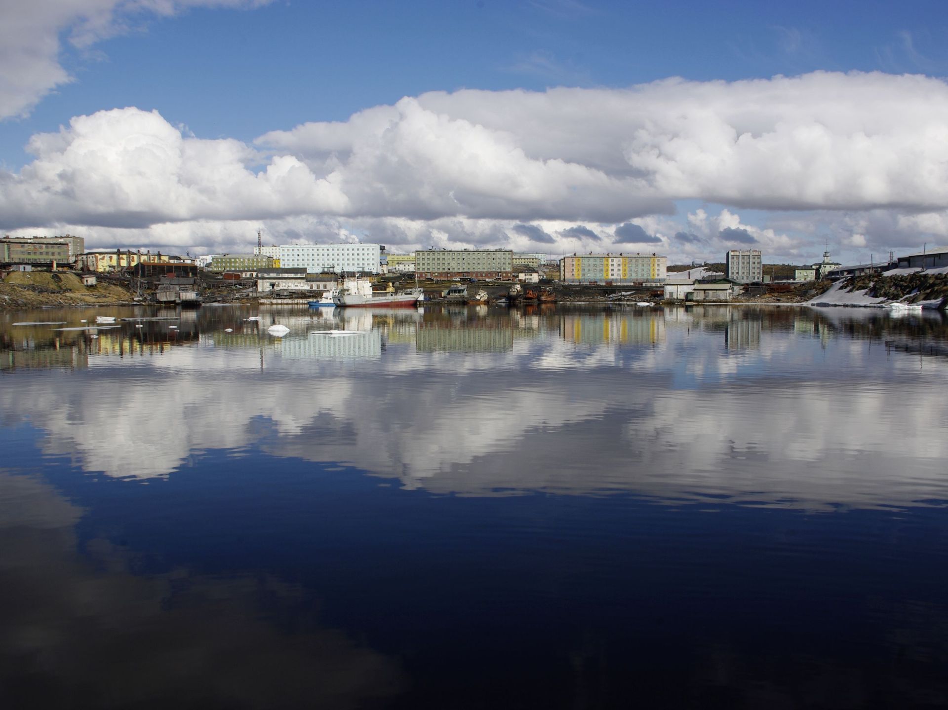
The Krasnoyarsk Territory has completed the aerial photography of Russia’s northernmost community – Dikson settlement. According to the Federal Service for State Registration, Cadastre and Cartography (Rosreestr), this is the key action in creating the National Spatial Data System (NSDS).“By 2030 we will produce an up-to-date cartographic basis of the entire Russian Federation territory under the NSDS national program. To date, the single electronic cartographic basis of the Krasnoyarsk Territory covers already 87.9 percent,” said head of the Rosreestr office for the Krasnoyarsk Territory Tatiana Goldobina.All the works, including the field compilation survey of the aerial photographs, were performed using unmanned aerial vehicles. The obtained data will be the basis of the updated maps and help in planning development of the Arctic territory.
2025
Новости
ru-RU
https://en.arctic.ru/docs/about/copyright.html
https://xn--c1acbl2abdlkab1og.xn--p1ai/
/img/07e9/09/0a/1046742_176:0:2907:2048_1920x0_80_0_0_0961a0d08cb8e81e9211e806eaed79c1.jpgkrasnoyarsk territory, news, science and technology
Aerial photography of Russia’s northernmost community completed
The Krasnoyarsk Territory has completed the aerial photography of Russia’s northernmost community – Dikson settlement. According to the Federal Service for State Registration, Cadastre and Cartography (Rosreestr), this is the key action in creating the National Spatial Data System (NSDS).
“By 2030 we will produce an up-to-date cartographic basis of the entire Russian Federation territory under the NSDS national program. To date, the single electronic cartographic basis of the Krasnoyarsk Territory covers already 87.9 percent,” said head of the Rosreestr office for the Krasnoyarsk Territory Tatiana Goldobina.
All the works, including the field compilation survey of the aerial photographs, were performed using unmanned aerial vehicles. The obtained data will be the basis of the updated maps and help in planning development of the Arctic territory.


