https://en.arctic.ru
Temperature-recording holes will be drilled in Yamal-Nenets Autonomous Area to study permafrost
Temperature-recording holes will be drilled in Yamal-Nenets Autonomous Area to study permafrost
Arctic.ru: discover how Russia implements its development goals in the Arctic and the Far East
2026-04-20T16:24
2026-04-20T16:24
2026-04-21T09:19
news
yamal-nenets autonomous area
science and technology
/img/07ea/04/14/1417836_0:53:1255:759_1920x0_80_0_0_fb74188597d704ad81d906414aeb5835.jpg
The data received from five new holes in the vicinity of Labytnangi will be included in the interactive permafrost map that presents precise information on the depth and extent of frozen soil, the Yamal-Nenets Autonomous Area press service reports.The map represents 70 background wells and more than 400 boreholes. The background wells were drilled in natural conditions not exposed to anthropogenic influences and the boreholes were made in the foundations of buildings.In addition, some properties in Labytnangi and Salekhard will be equipped with temperature recording instruments to improve the system of monitoring the frozen soil temperature under the buildings.At present, the permafrost monitoring system in Yamal covers Salekhard, Novy Urengoy, Labytnangi, Kharp urban-type settlement and the village of Gornoknyazevsk.The information received about frozen soils helps scientists in working out and introducing new mechanisms of erecting facilities in the Arctic conditions. The monitoring system can also help implement the plans of infrastructure development in the core inhabited localities of the region.
https://en.arctic.ru/20260122/1070886.html
2026
Новости
ru-RU
https://en.arctic.ru/docs/about/copyright.html
https://xn--c1acbl2abdlkab1og.xn--p1ai/
/img/07ea/04/14/1417836_84:0:1199:836_1920x0_80_0_0_f158737d48cc5450ebf24919d8f335f1.jpgnews, yamal-nenets autonomous area, science and technology
Temperature-recording holes will be drilled in Yamal-Nenets Autonomous Area to study permafrost
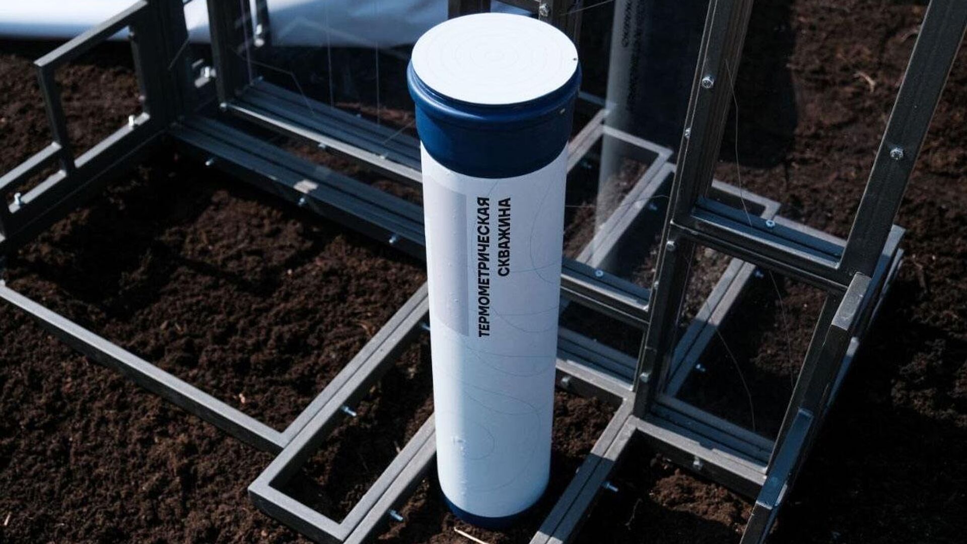
The data received from five new holes in the vicinity of Labytnangi will be included in the interactive permafrost map that presents precise information on the depth and extent of frozen soil, the Yamal-Nenets Autonomous Area press service reports.
The map represents 70 background wells and more than 400 boreholes. The background wells were drilled in natural conditions not exposed to anthropogenic influences and the boreholes were made in the foundations of buildings.
In addition, some properties in Labytnangi and Salekhard will be equipped with temperature recording instruments to improve the system of monitoring the frozen soil temperature under the buildings.
At present, the permafrost monitoring system in Yamal covers Salekhard, Novy Urengoy, Labytnangi, Kharp urban-type settlement and the village of Gornoknyazevsk.
The information received about frozen soils helps scientists in working out and introducing new mechanisms of erecting facilities in the Arctic conditions. The monitoring system can also help implement the plans of infrastructure development in the core inhabited localities of the region.


