https://en.arctic.ru
Multirole volcano observation outpost deployed in Kamchatka
Multirole volcano observation outpost deployed in Kamchatka
Arctic.ru: Discover how Russia implements its development goals in the Arctic and the Far East
2026-03-10T10:30
2026-03-10T10:30
2026-03-13T09:24
news
kamchatka territory
science and technology
infrastructure
/img/07ea/03/0a/1291952_0:0:3001:1688_1920x0_80_0_0_963b6ee79dfa04160f7fb5d6ea5cac0d.jpg
The Nalychevo station on Cape Nalychevsky is designed to monitor the Avacha group of volcanos and comprises several control systems, including seismic equipment, satellite transceivers and video cameras, as per the press service of the Kamchatka Territory Government.“We are consistently establishing a multi-level observation system where every element supplements all others. Seismic signals show subterranean processes; geodetic measurements record changes on the surface, and video observations make it possible to see external manifestations of activity. This overall data helps assess the state of volcanos and the level of potential danger,” said Danila Chebrov in charge of scientific research work.At the same time, scientists have unsealed an archive of seismic records and an improved factographic database called Volcanos of Kamchatka.It is emphasized that all collected materials are already used for research purposes. Data obtained by the Kamchatka network of satellite transceivers is used to compile a seismic-rupture model during a powerful magnitude 8.8 earthquake that hit the region on July 29, 2025.
2026
Новости
ru-RU
https://en.arctic.ru/docs/about/copyright.html
https://xn--c1acbl2abdlkab1og.xn--p1ai/
/img/07ea/03/0a/1291952_0:0:2621:1965_1920x0_80_0_0_4eaee6e27c2782e916b05488558ba6ee.jpgnews, kamchatka territory, science and technology, infrastructure
Multirole volcano observation outpost deployed in Kamchatka
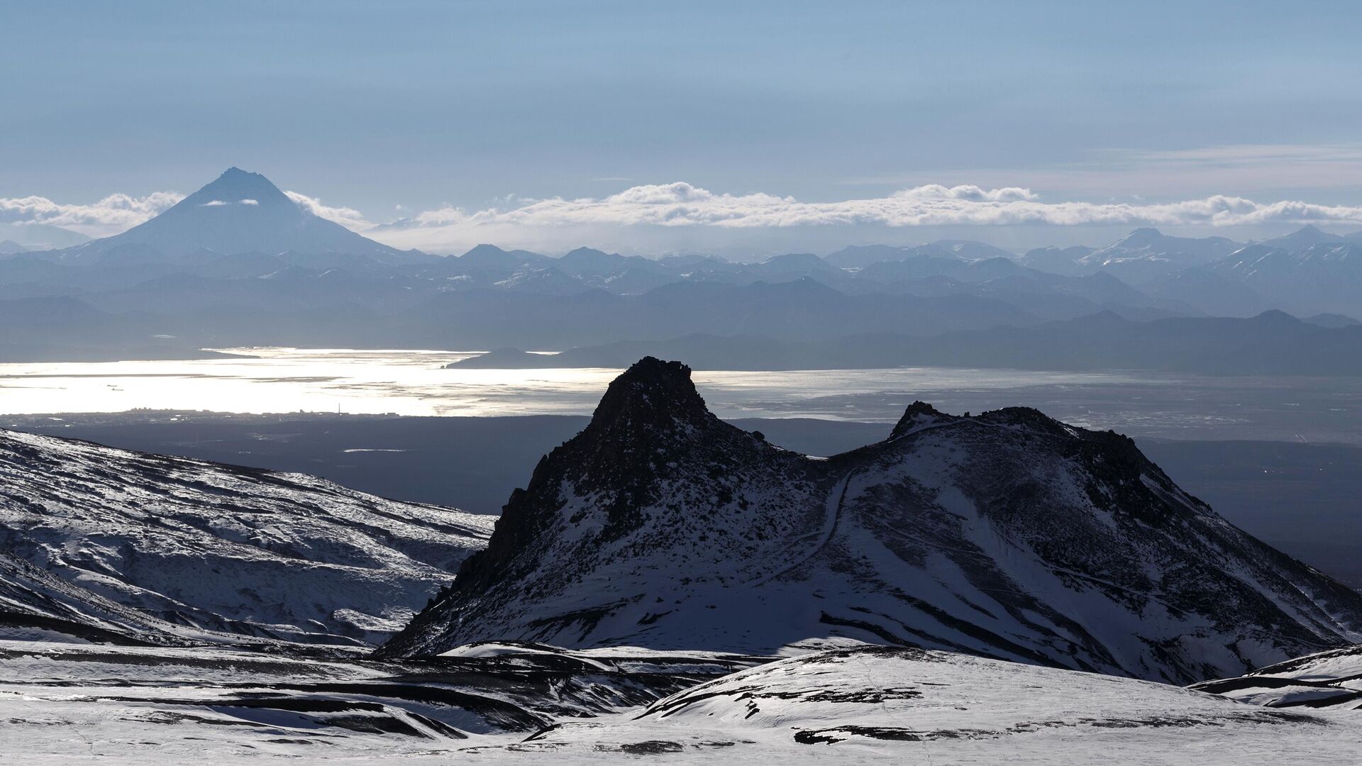
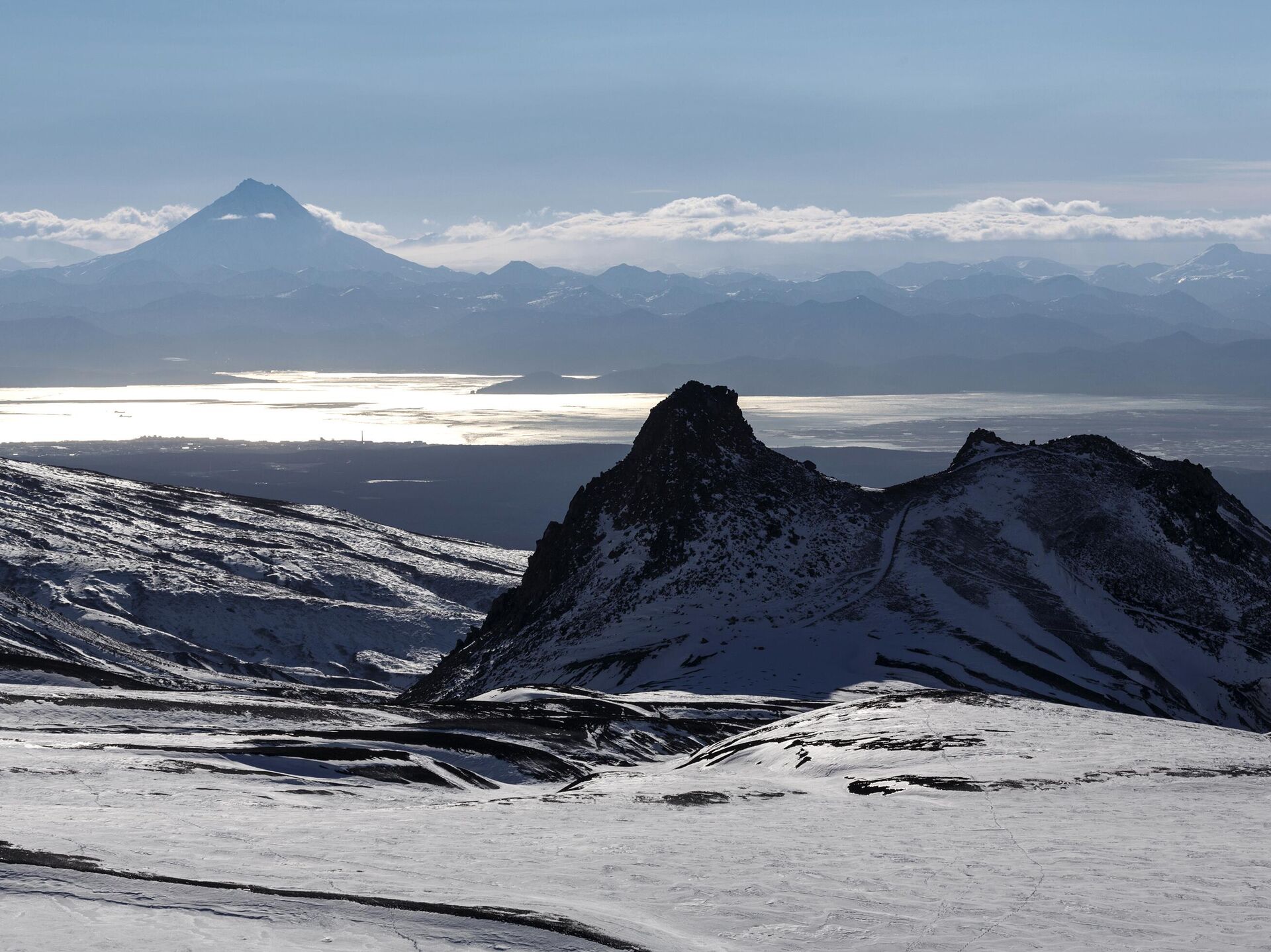
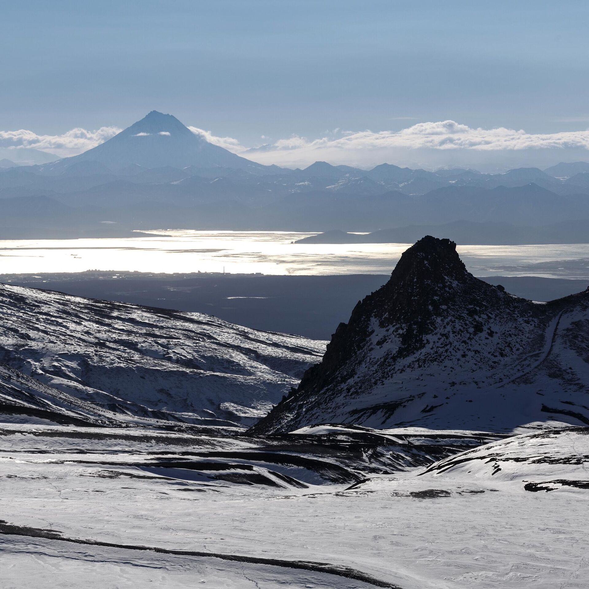
The Nalychevo station on Cape Nalychevsky is designed to monitor the Avacha group of volcanos and comprises several control systems, including seismic equipment, satellite transceivers and video cameras, as per the press service of the Kamchatka Territory Government.
“We are consistently establishing a multi-level observation system where every element supplements all others. Seismic signals show subterranean processes; geodetic measurements record changes on the surface, and video observations make it possible to see external manifestations of activity. This overall data helps assess the state of volcanos and the level of potential danger,” said Danila Chebrov in charge of scientific research work.
At the same time, scientists have unsealed an archive of seismic records and an improved factographic database called Volcanos of Kamchatka.
It is emphasized that all collected materials are already used for research purposes. Data obtained by the Kamchatka network of satellite transceivers is used to compile a seismic-rupture model during a powerful magnitude 8.8 earthquake that hit the region on July 29, 2025.


